Overview: What is an AT thru-hike?
First off, great job starting your research. Below is a breakdown of what you need to know to dominate your thru-hike. The Appalachian Trail (AT), completed in 1948, is an iconic continuous footpath stretching 2,185 miles along the Appalachian Mountains from Springer Mountain, Georgia to Mt. Katahdin, Maine. Anyone who completes the entire Trail within one-year is considered a "thru-hiker". A thru-hike takes 4-6 months to complete.
Timing and Direction: North vs South?
 © Gerry D (CC BY-SA 3.0)
Before deciding when to go, decide what direction you want to go. Your options:
A) NOBO (Northbound = GA to ME) 90% of all thru-hikers go North. Starting in early Spring and ending in late summer, NOBOs hike with the blossoming Spring season. NOBOs enjoy larger social groups, but may complain about crowded shelters. I recommend starting at the southern terminus (Springer Mountain, GA) anytime from March 1 - 30.
B) SOBO (Southbound = ME to GA) 10% go South. Starting in early summer and ending in late fall, SOBOs hike with the bright Fall foliage. SOBOs enjoy smaller social groups and serene trail time, but may complain about lack of infrastructure (some hostels and shuttle services are closed). I recommend starting at the northern terminus (Mt. Katahdin, ME) anytime from June 1 - 30.
C) FLIP FLOP Hike to the halfway point (typically Harpers Ferry, WV). Then get transportation to the other end of the trail and hike the second half.
D) YO YO Hike a short section. Transport to the beginning of another short section and repeat.
Physical Preparation
Training: You should have a basic level of fitness. As in be able to run a 10 minute mile. Other than that, I vote just train as you hike. I mean, how on earth can you condition your body for hiking every day for 5 months other than to just do it?
Pace: If the average thru-hike takes about 5 months (150 days) and the Trail is 2,185 miles, you will average ~14.5 miles/ day (2,185/150). However, this average does not account for two things:
1. "Zero Days" or days in town where you relax those tired feet, wait out bad weather, enjoy the lovely fruits of civilization... and hike a big, fat, ZERO miles.
2. Your first month will be slow. It will take time to get your "hiking legs"... or be physically conditioned to handle the new high-mileage lifestyle. You don't want a stress induced injury.
For me, it was easier to break mileage down by week rather than by day. 5 months is 21.5 weeks which equals about 100 miles/ week. Here is what typical weekly mileage might look like:
Weekly schedule
- Day 1: 20 miles
- Day 2: 17 miles
- Day 3: 13 miles
- Day 4: 20 miles
- Day 5: 17 miles
- Day 6: 13 miles
- Day 7: Rest
Budget: How much does it Cost?
My gear was probably slightly pricier than some. But, otherwise, I ate and slept like an average budget minded thru-hiker. Here is a rough breakdown of the main expenses:
1. Gear: Tent/ Shelter ($250) + Sleeping Bag ($150) + Pack ($150) + Down Jacket ($150) + Shell Jacket ($100) + Sleeping Pad ($100) + Shoes ($100) + Poles ($75) + Stove/ Kitchen ($60) + Bag Liner ($50) + Water Filter ($40) + Headlamp ($40) + Misc ($185) = $1,450
2. Food:
a. Trail: $13/ day X 130 days = $1,690
b. Town: $25/ day X 20 days = $500
3. Accommodations (hostel or split a motel): $15/ night X 20 nights = $300
4. Misc: Airfare/ shuttles ($250) + Replacement gear ($150) = $400
Total Cost of My Thru-Hike: $4,340 *Note this budget can vary A LOT depending on what gear you already have, eating habits, lodging needs, etc.
Navigation: Can I get lost?
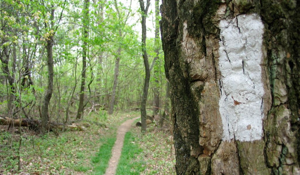
Map and Compass. Simply put - you don't need 'em. 99% of the trail is pretty obvious and marked by "blaze's" every 50-100 yards. AT blazes are 2X6 inch white stripes of paint located near eye-level, typically on a tree.
 © Compass Points Media (CC BY-ND 2.0)
Get the AWOL guide and thank me later. It provides a horizontal profile of the entire trail. Having this detailed trail gradient info is SUPER HELPFUL. Not only does it inform you how difficult or easy the upcoming miles are, but about upcoming water sources and shelters. Complete with hostel, shuttle, town info as well as a bunch of other good stuff.
Permits. Overall, you don't need a permit to hike the AT. There are, however, two sections through National Parks that require a permit to camp: Great Smoky Mountain National Park and Shenandoah National Park.
Sleeping: Where will I sleep?
There are hostels and motels in town. Towns are scattered anywhere from 10 - 100 miles from each other. On average you will only stay in town about once a week. This means you will be under the stars for the other 6 nights.
Two sleeping options on the Trial:
1. Your own tent/ hammock: You can set this up almost anywhere. However, it is best to minimize your environmental footprint and stay at already designated sites (generally right by the shelters).
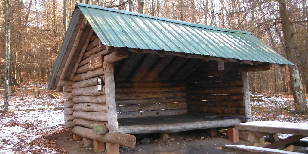
2. The AT Shelters: These are three walled wooden structures located about every 10 miles along the Trail. They are about 8 x 12 feet and can sleep 6 - 10 people.

Sleeping in the shelters is ideal. You do not want to set up and break camp every day. It is, not only monotonous, but the last thing you want to do at the end of an exhausting day. Shelters also provide space to hang out, hang clothes, cook and socialize... which is a gift if the weather is bad.
A few ultralight thru-hikers ditch the weight of a tent/ hammock and opt to stay only in the shelters. This is risky for several reasons though. The shelter could be full when you arrive, you could be exhausted and not be up for pushing onto the shelter, you could encounter some impromptu bad weather and need to set up camp pronto. You could also stumble across a nice perch to watch the sunrise from.
I vote stay in shelters whenever possible, but bring your own tent/ hammock for backup. Having your own shelter will give you, at times, much needed flexibility.
Food and Supplies: How will I eat?
There are a couple of options to get your goods:
1. Resupply in towns: As mentioned, you will go into town about once a week. Most towns will have a grocery store to stock up on your food for the approaching section... until the next town. There are several outfitters scattered along the trail as well to replace any worn or broken gear.
2. Mail Drops: You can pre plan all of your food and strategically ship it to Post Offices in trail towns. This can be tricky though. Your dietary needs and taste buds will probably be different than you planned for prior to departing. Also, mail drops force you to stop at each of those specific towns and arrive when the post office is open.
"Bounce boxes" can be a good mail drop compromise. Put supplies you need, but don't need ON the Trail (like extra food, spare batteries, spare medicine, extra socks, journal, whatever) into a box and ship (or bounce) it on to your next trail town and repeat.
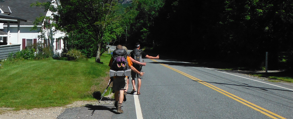
Okay, how do I get from the Trail to town? Every now and then, the Trail is close enough to walk on into town or it actually goes through town. However, most of the time you will hitchhike.

Yep - trail town citizens are used to hikers at road crossings and are a pretty helpful bunch. It's economical and can be fun meeting new folks. If in a really remote section, some hostels provide shuttles.
Water: Can I drink from the streams?
Eh, sort of. Yes, you will rely on nature to keep you hydrated - ponds, streams, waterfalls, springs, etc. But, you should always treat your water (filter, chemical drops, light sterilization, etc) before drinking it.
Most of the trail is very wet (minus some sections in PA) and water sources are every few miles. You should always carry a liter just in case your next water source is dry or there is an emergency. I would almost always keep a liter in my bag and chug as much as I could at the water source.
Dangers: Is the AT safe?
Basically, it is very safe. However, there are some things you should be aware of and prepare for...
Animals: Black bears and snakes (namely copperheads and timber rattlers). Keep your distance, be respectful and hang your food. They're much more scared of you than you are of them.
Bugs: Ticks can carry lyme disease and mosquitoes will drive you crazy. Wear repellent and give yourself a "tick check" as often as possible.
Weather: On both ends of the spectrum, your colder months can cause hypothermia and hotter months, dehydration. Lightning storms, particularly on balds, can be a danger as well.
Sanitation: Always treat your water. Use hand sanitizer as much as possible - mice (and other hikers!) are in some shelters and can spread some nasty stuff.
Poison Ivy: Know what it looks like and avoid it.
People: Hikers are good people. But, just like anywhere, there can be some bad apples. Try to stay with a group.
Group vs Solo: Will I get lonely?
Nah. I'd guess about 90% of all thru-hikers set off solo. Therefore, most people don't know anyone and are eager to strike up a conversation. Everyone is experiencing the exact same thing you are and camaraderie is inevitable. Some NOBO's may even wish they have more alone time on the Trail.
There is not really a "typical" thru-hiker either. I hiked with solo hikers and couples ranging from 18 - 70 years old... all hiking for different reasons. If still nervous about going it alone, check out the community on whiteblaze.net to see about starting with some other solo hikers. Don't stress though- you'll be good :)


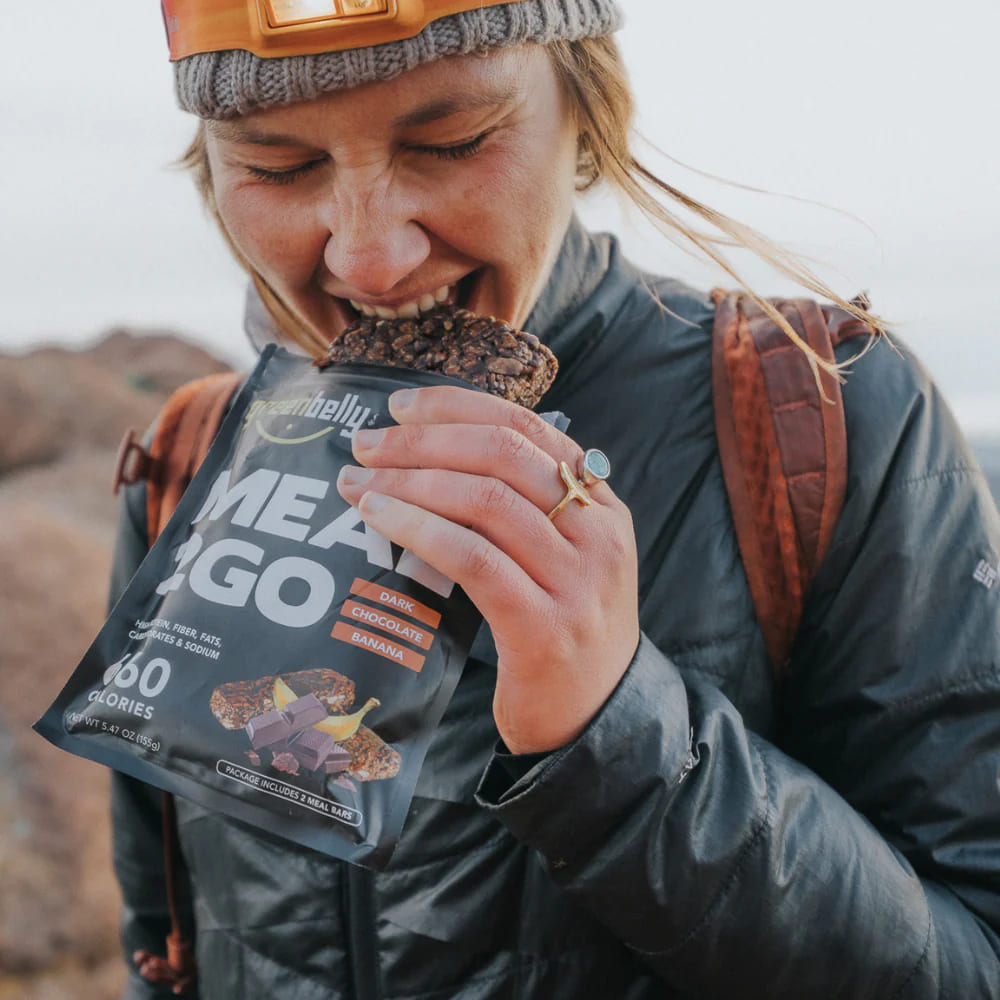
 650-Calorie Fuel